

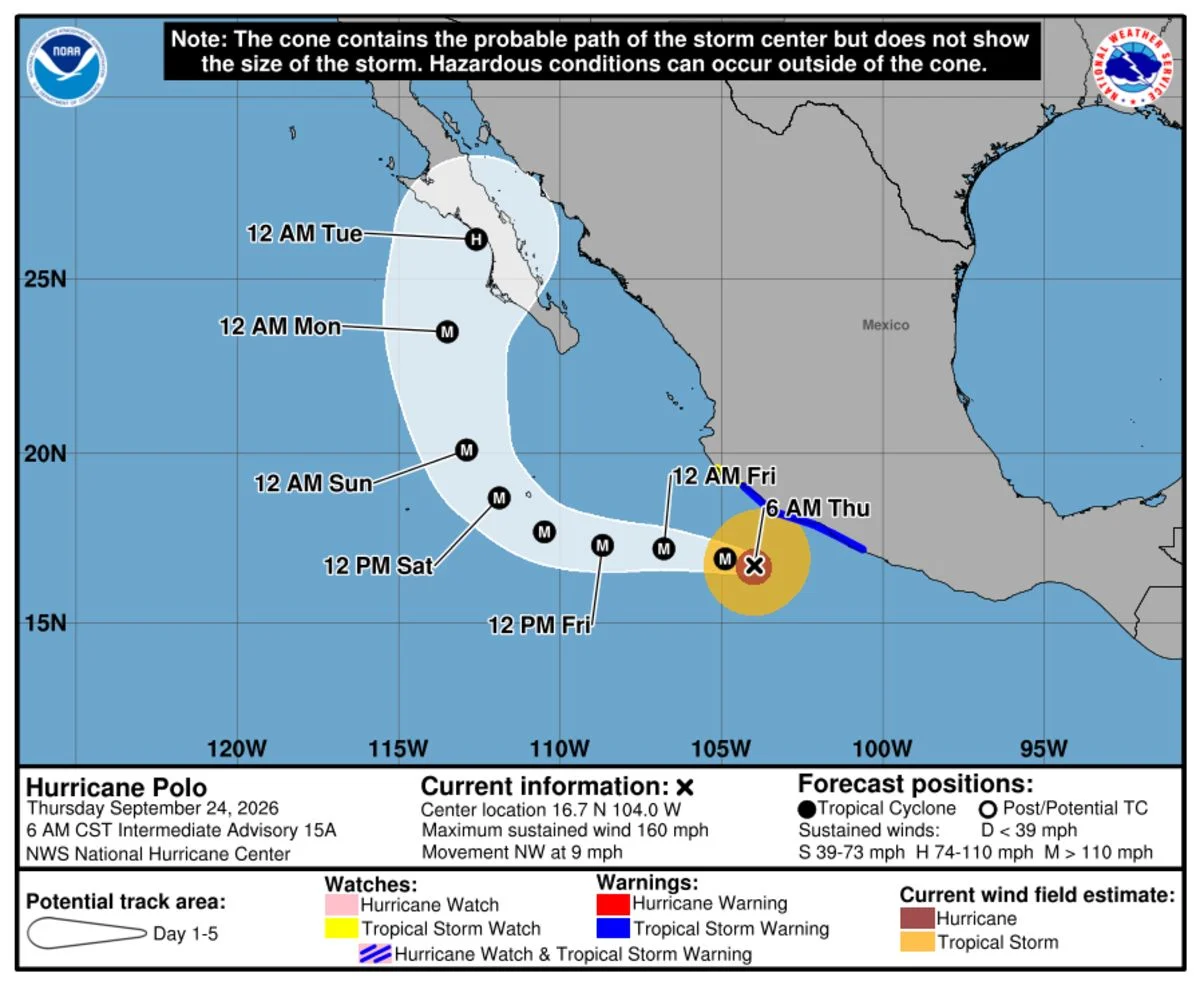
By midday Sept. 24, Category 4 Hurricane Polo had maximum sustained winds of 155 mph about 195 miles west-southwest of Zihuatanejo, Mexico. A tropical-storm warning was in effect from Tecpan de Galeana to Manzanillo; flooding rain and dangerous surf were forecast.
The National Hurricane Center said Polo’s core would likely remain offshore of southwestern Mexico on Sept. 24 before moving farther out to sea. Forecasters expected 4 to 6 inches of rain along Guerrero’s coast, with isolated totals up to 8 inches, raising flooding and mudslide risks, especially on steep terrain; coastal parts of Michoacán, Colima and Jalisco could get 2 to 4 inches. A tropical-storm watch extended from Manzanillo to Playa Perula; swells could bring life-threatening surf, rip currents and coastal flooding toward Baja California Sur from Friday into the weekend.
Earlier in the week, Polo’s winds rose from 85 mph to a peak of 180 mph in 22 hours. Hurricane specialist Michael Lowry said the storm strengthened from a disorganized tropical depression to Category 5 in 42 hours, the fastest such intensification on record in the Western Hemisphere. Phil Klotzbach said its lowest central pressure, 892 millibars, was the second-lowest recorded in a hurricane; Hurricane Patricia reached 872 millibars in 2015.
