

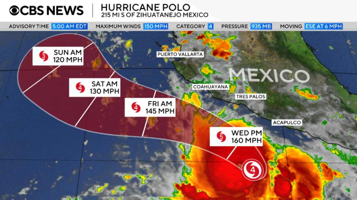
The hurricane center reported Hurricane Polo weakened to Category 4, with sustained winds of 155 mph Wednesday evening. It was expected to skirt Mexico’s southwest coast without landfall in the next few days; rain could cause life-threatening flooding and mudslides.
Mexico issued a tropical storm warning from Tecpan de Galeana in Guerrero to Punta San Telmo in Michoacán, and a watch from Punta San Telmo to Playa Perula in Jalisco. Through Thursday, parts of Guerrero and Michoacán could get 3–6 inches of rain, with up to 8 inches in some spots; coastal Oaxaca, Colima and Jalisco could get 2–4 inches. Life-threatening surf and rip currents were also forecast.
Between early Monday and about the same time Tuesday, Polo’s winds rose from 45 to 150 mph, meeting the hurricane center’s definition of extreme rapid intensification: a gain of at least 58 mph in 24 hours. Its winds reached as high as 180 mph on Tuesday. By central pressure, Polo ranked second among Eastern Pacific hurricanes on record, behind 2015’s Hurricane Patricia; its winds tied 2009’s Hurricane Rick for third. Tropical Storm Nolo also formed in the Pacific Wednesday, prompting a hurricane watch for Hawaii’s Big Island; forecasters expected it to become a hurricane Thursday.
