

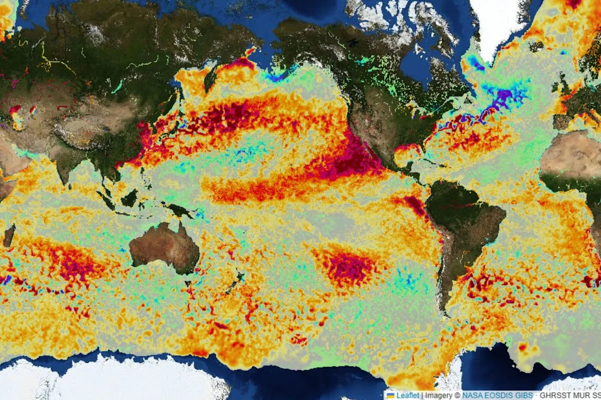
An ElNinoLive map using NASA satellite data shows the equatorial Pacific’s warm-water band broadening from April to September. Federal forecasters said El Niño is highly likely to become very strong this fall and winter, with a 75 percent chance of a historic October–December 事件.
NOAA cautioned that the map shows sea-surface temperature anomalies, not the measure it uses to assess El Niño’s overall strength or effects. National Weather Service meteorologist Erica Cei said day-to-day changes in equatorial Pacific temperatures do not affect the event’s overall strength or downstream impacts.
California Gov. Gavin Newsom declared a statewide emergency Monday to mobilize resources for a potentially historic El Niño winter. His proclamation directs water officials to prepare flood-fighting supplies and engage with dam owners and flood-control agencies. Transportation officials must identify vulnerable infrastructure and plan for road-closure, traffic-control, emergency-communications and snow equipment.
